Geolocate

Herhet topographic map

Click on the map to display elevation.

About this map

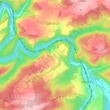
Name: Herhet topographic map, elevation, terrain.

Location: Herhet, Gendron, Houyet, Dinant, Namur, Wallonie, 5561, Belgique (50.17665 4.96845 50.21665 5.00845)

Average elevation: 643 ft

Minimum elevation: 341 ft

Maximum elevation: 909 ft

Gear up for your next adventure:

🛰️Handheld GPS Units - Professional satellite navigators for precise backcountry mapping
🧯Portable Fire Pit - Compact fire pit for camping spots
🪑Ultralight Camp Chairs - Portable seating for resting after a long day of mapping
🎒Gear Packing Cubes - Organize your backpack efficiently
🚁Photography Drones - Capture stunning aerial views of landforms and topography

As an Amazon Associate, this site earns from qualifying purchases at no extra cost to you.