Geolocate

Moberly topographic map

Click on the map to display elevation.

About this map

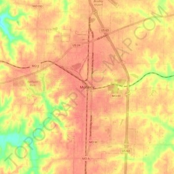
Name: Moberly topographic map, elevation, terrain.

Location: Moberly, Randolph County, Missouri, 65270, United States (39.38011 -92.47643 39.46011 -92.39643)

Average elevation: 846 ft

Minimum elevation: 722 ft

Maximum elevation: 896 ft

Randolph County trails, hiking, mountain biking, running and outdoor activities

Gear up for your next adventure:

🚑Emergency Bivvies - Heat-reflective sleeping bags for survival situations
💧Water Purification System - Clean water on the trail with reliable purifiers
👟Men's Trail Runners - Lightweight footwear for fast-paced exploration and light hiking
🛠️Backpacking Tool Kit - Essential toolkit for outdoor repairs
🔋Rechargeable Batteries - Power up your outdoor devices

As an Amazon Associate, this site earns from qualifying purchases at no extra cost to you.