Geolocate

Amritsar topographic map

Click on the map to display elevation.

About this map

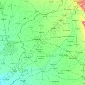
Name: Amritsar topographic map, elevation, terrain.

Location: Amritsar, Punjab, 143115, India (30.88333 74.28333 32.28333 75.68333)

Average elevation: 761 ft

Minimum elevation: 614 ft

Maximum elevation: 1,906 ft

Gear up for your next adventure:

🌄Hiking Binoculars - Compact binoculars for scenic views and trail spotting
💧Water Filtration Bottles - Safely drink from streams and lakes while exploring
🪵Folding Camp Saw - Compact saw for wood and campsite work
📶Vehicle Signal Boosters - Improve reception in rural areas while driving to trailheads
🔭Stargazing Telescopes - Perfect for camping in low-light pollution areas shown on maps

As an Amazon Associate, this site earns from qualifying purchases at no extra cost to you.