Geolocate

Vargas topographic map

Click on the map to display elevation.

About this map

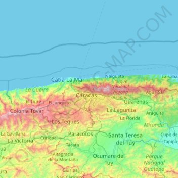
Name: Vargas topographic map, elevation, terrain.

Location: Vargas, Región Capital, Venezuela (10.38767 -67.41273 10.69044 -66.30938)

Average elevation: 1,365 ft

Minimum elevation: -3 ft

Maximum elevation: 8,835 ft

Gear up for your next adventure:

🪑Ultralight Camp Chairs - Portable seating for resting after a long day of mapping
🌲Outdoor Survival Books - Best books on survival skills
🗃️Trail First Aid Kit - Essential kit for outdoor injuries and emergencies
🖼️Topo Map Wall Art - Decorative topographic prints of famous peaks and regions
🛠️Backpacking Tool Kit - Essential toolkit for outdoor repairs

As an Amazon Associate, this site earns from qualifying purchases at no extra cost to you.