Geolocate

Williston topographic map

Click on the map to display elevation.

About this map

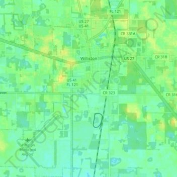
Name: Williston topographic map, elevation, terrain.

Location: Williston, Levy County, Florida, United States (29.34152 -82.49331 29.41083 -82.43035)

Average elevation: 75 ft

Minimum elevation: 49 ft

Maximum elevation: 108 ft

Levy County trails, hiking, mountain biking, running and outdoor activities

Other topographic maps

Click on a map to view its topography, its elevation and its terrain.

East Bronson

United States > Florida > Levy County

Average elevation: 89 ft

Raleigh

United States > Florida > Levy County

Average elevation: 75 ft

Morriston

United States > Florida > Levy County

Average elevation: 66 ft

Crackertown

United States > Florida > Levy County > Inglis

Average elevation: 30 ft

Cedar Keys

United States > Florida > Levy County

Average elevation: 10 ft

East Bronson

United States > Florida > Levy County

Average elevation: 89 ft

Morriston

United States > Florida > Levy County

Average elevation: 66 ft

Gear up for your next adventure:

🗺️Topographic Maps - Detailed topo maps for hiking, exploring and outdoor navigation
🔦LED Headlamp - Bright and durable LED headlamp for night navigation
🎒Waterproof Dry Bags - Keep your electronics and maps dry inside your pack
🧯Emergency Survival Kit - All‑in‑one survival essentials for the backcountry
🛡️Bear Spray Outdoor - Protection in bear country hikes

As an Amazon Associate, this site earns from qualifying purchases at no extra cost to you.