
Elizabethtown topographic map
Click on the map to display elevation.
About this map
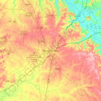
Name: Elizabethtown topographic map, elevation, terrain.
Location: Elizabethtown, Hardin County, Kentucky, 42701, United States (37.53395 -86.01913 37.85395 -85.69913)
Average elevation: 725 ft
Minimum elevation: 420 ft
Maximum elevation: 1,004 ft
Hardin County trails, hiking, mountain biking, running and outdoor activities