Geolocate

Pecol topographic map

Click on the map to display elevation.

About this map

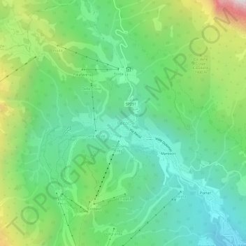
Name: Pecol topographic map, elevation, terrain.

Location: Pecol, Val di Zoldo, Belluno, Veneto, Italy (46.37386 12.08103 46.41386 12.12103)

Average elevation: 5,351 ft

Minimum elevation: 3,773 ft

Maximum elevation: 8,950 ft

Gear up for your next adventure:

🗺️NatGeo Topo Maps - High-quality waterproof printed topographic maps of US Parks
🛡️Insect Repellent - Protection against bugs during outdoor activities
😴Insulated Sleeping Pads - Compact and warm pads for high-elevation camping
🎁Geography Themed Gifts - Unique gift ideas for map lovers and geography enthusiasts
🪶Wildlife Field Guides - Learn animal tracking and species ID

As an Amazon Associate, this site earns from qualifying purchases at no extra cost to you.