
Make a donation
Gear up for your next adventure:
As an Amazon Associate, this site earns from qualifying purchases at no extra cost to you.
Caucasus Mountains topographic map
Click on the map to display elevation.
Make a donation
Gear up for your next adventure:
As an Amazon Associate, this site earns from qualifying purchases at no extra cost to you.
Caucasus Mountains
The climate of the Caucasus varies both vertically (according to elevation) and horizontally (by latitude and location). Temperature generally decreases as elevation rises. Average annual temperature in Sokhumi, Abkhazia at sea level is 15 °C (59 °F) while on the slopes of Mt.Kazbek at an elevation of 3,700 metres (12,100 ft), average annual temperature falls to −6.1 °C (21.0 °F). The northern slopes of the Greater Caucasus Mountain Range are 3 °C (5.4 °F) colder than the southern slopes. The highlands of the Lesser Caucasus Mountains in Armenia, Azerbaijan, and Georgia are marked by sharp temperature contrasts between the summer and winter months due to a more continental climate.
Make a donation
Gear up for your next adventure:
As an Amazon Associate, this site earns from qualifying purchases at no extra cost to you.
About this map
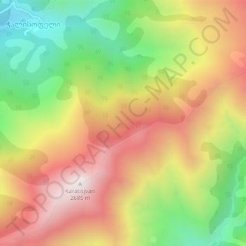
Name: Caucasus Mountains topographic map, elevation, terrain.
Average elevation: 7,178 ft
Minimum elevation: 5,505 ft
Maximum elevation: 8,802 ft
Make a donation
Gear up for your next adventure:
As an Amazon Associate, this site earns from qualifying purchases at no extra cost to you.