Geolocate

Dalton topographic map

Click on the map to display elevation.

About this map

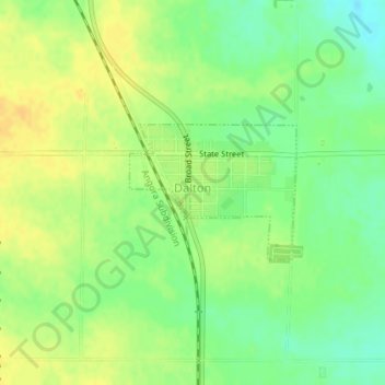
Name: Dalton topographic map, elevation, terrain.

Location: Dalton, Cheyenne County, Nebraska, 69131, United States (41.40211 -102.97971 41.41167 -102.96408)

Average elevation: 4,265 ft

Minimum elevation: 4,216 ft

Maximum elevation: 4,301 ft

Cheyenne County trails, hiking, mountain biking, running and outdoor activities

Gear up for your next adventure:

🛠️Backpacking Tool Kit - Essential toolkit for outdoor repairs
🎁Geography Themed Gifts - Unique gift ideas for map lovers and geography enthusiasts
🛡️Bear Spray Outdoor - Protection in bear country hikes
📌Outdoor GPS Map App - Apps and devices for digital topographic navigation
😴Insulated Sleeping Pads - Compact and warm pads for high-elevation camping

As an Amazon Associate, this site earns from qualifying purchases at no extra cost to you.