
Thank you for supporting this site ❤️
Make a donation
Make a donation
Gear up for your next adventure:
As an Amazon Associate, this site earns from qualifying purchases at no extra cost to you.
Haut-Bois topographic map
Click on the map to display elevation.
Thank you for supporting this site ❤️
Make a donation
Make a donation
Gear up for your next adventure:
As an Amazon Associate, this site earns from qualifying purchases at no extra cost to you.
About this map
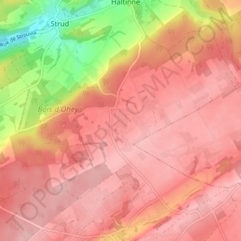
Name: Haut-Bois topographic map, elevation, terrain.
Location: Haut-Bois, Gesves, Namen, Wallonië, 5340, België (50.41128 5.05298 50.45128 5.09298)
Average elevation: 784 ft
Minimum elevation: 436 ft
Maximum elevation: 928 ft
Thank you for supporting this site ❤️
Make a donation
Make a donation
Gear up for your next adventure:
As an Amazon Associate, this site earns from qualifying purchases at no extra cost to you.