
Thank you for supporting this site ❤️
Make a donation
Make a donation
Gear up for your next adventure:
As an Amazon Associate, this site earns from qualifying purchases at no extra cost to you.
Newcastle topographic map
Click on the map to display elevation.
Thank you for supporting this site ❤️
Make a donation
Make a donation
Gear up for your next adventure:
As an Amazon Associate, this site earns from qualifying purchases at no extra cost to you.
About this map
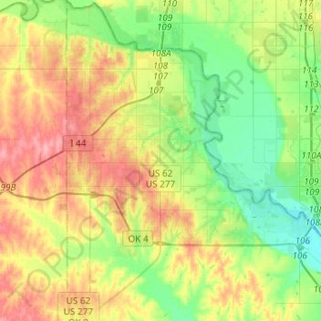
Name: Newcastle topographic map, elevation, terrain.
Location: Newcastle, McClain County, Oklahoma, 73065, United States (35.13514 -97.67098 35.33357 -97.48445)
Average elevation: 1,224 ft
Minimum elevation: 1,089 ft
Maximum elevation: 1,417 ft
McClain County trails, hiking, mountain biking, running and outdoor activities
Thank you for supporting this site ❤️
Make a donation
Make a donation
Gear up for your next adventure:
As an Amazon Associate, this site earns from qualifying purchases at no extra cost to you.