Geolocate

Vidin topographic map

Click on the map to display elevation.

About this map

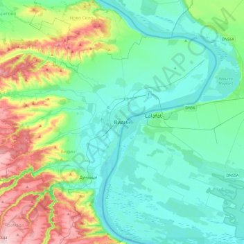
Name: Vidin topographic map, elevation, terrain.

Location: Vidin, 3700, Bulgaria (43.82572 22.71722 44.14572 23.03722)

Average elevation: 269 ft

Minimum elevation: 85 ft

Maximum elevation: 879 ft

Other topographic maps

Click on a map to view its topography, its elevation and its terrain.

Makresh

Bulgaria > Vidin

Average elevation: 1,217 ft

Gear up for your next adventure:

🥾Hiking Shoes - Durable and comfortable shoes for trail hiking
🧭Hiking Compass - Precision compass for reliable navigation in the wilderness
🧭Compass with Lanyard - Easy‑carry compass for navigation
🌲Outdoor Survival Books - Best books on survival skills
🥾Men's Hiking Boots - Durable, waterproof footwear for rugged terrain and steep inclines

As an Amazon Associate, this site earns from qualifying purchases at no extra cost to you.