
Thank you for supporting this site ❤️
Make a donation
Make a donation
Gear up for your next adventure:
As an Amazon Associate, this site earns from qualifying purchases at no extra cost to you.
Aliaga topographic map
Click on the map to display elevation.
Thank you for supporting this site ❤️
Make a donation
Make a donation
Gear up for your next adventure:
As an Amazon Associate, this site earns from qualifying purchases at no extra cost to you.
About this map
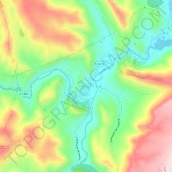
Name: Aliaga topographic map, elevation, terrain.
Location: Aliaga, Cuencas Mineras, Teruel, Aragon, 44150, Spain (40.65357 -0.72317 40.69357 -0.68317)
Average elevation: 4,055 ft
Minimum elevation: 3,543 ft
Maximum elevation: 4,724 ft
Thank you for supporting this site ❤️
Make a donation
Make a donation
Gear up for your next adventure:
As an Amazon Associate, this site earns from qualifying purchases at no extra cost to you.