Geolocate

Fucheng County topographic map

Click on the map to display elevation.

About this map

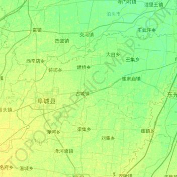
Name: Fucheng County topographic map, elevation, terrain.

Location: Fucheng County, Hengshui, Hebei, 053700, China (37.76456 116.04802 38.02539 116.55944)

Average elevation: 56 ft

Minimum elevation: 36 ft

Maximum elevation: 75 ft

Other topographic maps

Click on a map to view its topography, its elevation and its terrain.

Jiahui

China > Hebei > Hengshui

Average elevation: 92 ft

Gear up for your next adventure:

🧭Outdoor Navigation Book - Learn advanced navigation skills
🪶Trail Camera - Capture wildlife on your hikes
🌄Hiking Binoculars - Compact binoculars for scenic views and trail spotting
🪶Wildlife Field Guides - Learn animal tracking and species ID
🥾Hiking Shoes - Durable and comfortable shoes for trail hiking

As an Amazon Associate, this site earns from qualifying purchases at no extra cost to you.