Geolocate

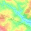
Chapada do Araripe topographic map

Click on the map to display elevation.

About this map

Name: Chapada do Araripe topographic map, elevation, terrain.

Location: Chapada do Araripe, Araripina, Região Geográfica Imediata de Araripina, Região Geográfica Intermediária de Petrolina, Pernambuco, Região Nordeste, Brasil (-7.53549 -40.50715 -7.48502 -40.48678)

Average elevation: 2,349 ft

Minimum elevation: 2,106 ft

Maximum elevation: 2,595 ft

Other topographic maps

Click on a map to view its topography, its elevation and its terrain.

Sítio São Paulo

Brasil > Pernambuco > Araripina

Average elevation: 2,339 ft

Serra da Torre

Brasil > Pernambuco > Araripina

Average elevation: 2,444 ft

Sítio Santa Cruz

Brasil > Pernambuco > Araripina

Average elevation: 1,969 ft

Lagoa do Barro

Brasil > Pernambuco > Araripina

Average elevation: 1,759 ft

Gear up for your next adventure:

🚁Photography Drones - Capture stunning aerial views of landforms and topography
🌧️Backpack Rain Cover - Keep gear dry in wet weather
🪶Camp Gear Gift Set - Perfect gift bundle for outdoor fans
👟Men's Trail Runners - Lightweight footwear for fast-paced exploration and light hiking
🧢Sun Protection Hats - Wide-brimmed and UPF-rated hats for high-altitude sun safety

As an Amazon Associate, this site earns from qualifying purchases at no extra cost to you.