Geolocate

Ocracoke topographic map

Click on the map to display elevation.

About this map

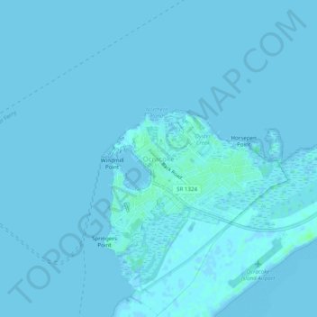
Name: Ocracoke topographic map, elevation, terrain.

Location: Ocracoke, Hyde County, North Carolina, 27960, United States (35.09462 -76.00101 35.13462 -75.96101)

Average elevation: 3 ft

Minimum elevation: -7 ft

Maximum elevation: 23 ft

Other topographic maps

Click on a map to view its topography, its elevation and its terrain.

Gear up for your next adventure:

Backpacking Tents - Weight-optimized shelters for multi-day topographic surveys
🧺Microfiber Travel Towels - Compact and fast-drying towels for trail use
😴Insulated Sleeping Pads - Compact and warm pads for high-elevation camping
📦Gear Storage Bags - Organize and protect outdoor equipment
📷Action Camera - Capture your outdoor adventures in HD

As an Amazon Associate, this site earns from qualifying purchases at no extra cost to you.