Geolocate
👉 Easily get elevation data in JSON, GeoTIFF and KML formats using Elevation API
Thank you for supporting this site ❤️
Make a donation

Novi Ligure topographic map

Click on the map to display elevation.

About this map

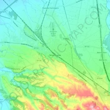
Name: Novi Ligure topographic map, elevation, terrain.

Location: Novi Ligure, Alessandria, Piemonte, 15067, Italia (44.72085 8.74955 44.80085 8.82955)

Average elevation: 659 ft

Minimum elevation: 492 ft

Maximum elevation: 1,099 ft

Gear up for your next adventure:

🧯Portable Fire Pit - Compact fire pit for camping spots
🛏️Cold Weather Sleeping Bag - Warm sleeping bag for cold conditions
GPS Sports Watch - GPS watch for running, hiking and training
📚Navigation Handbooks - Master the art of reading topographic maps and using a compass
🥘Titanium Cookware - Durable, featherlight pots and pans for backpacking

As an Amazon Associate, this site earns from qualifying purchases at no extra cost to you.