Geolocate

Whitstable topographic map

Click on the map to display elevation.

About this map

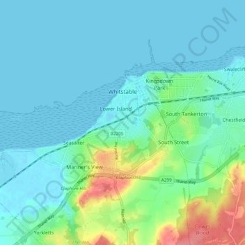
Name: Whitstable topographic map, elevation, terrain.

Location: Whitstable, Kent, South East England, England, United Kingdom (51.33643 0.98785 51.37030 1.08003)

Average elevation: 49 ft

Minimum elevation: -3 ft

Maximum elevation: 240 ft

Gear up for your next adventure:

👟Trail Running Shoes - Lightweight shoes for trail runners
🚑Emergency Bivvies - Heat-reflective sleeping bags for survival situations
🚗GPS Dash Cams - Record your scenic drives through mountain passes and canyons
🛰️Satellite Messengers - Emergency SOS and two-way messaging for off-grid adventures
🦺Reflective Outdoor Gear - Safety gear for low‑light conditions

As an Amazon Associate, this site earns from qualifying purchases at no extra cost to you.