Geolocate

Gugo topographic map

Click on the map to display elevation.

About this map

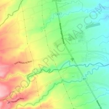
Name: Gugo topographic map, elevation, terrain.

Location: Gugo, Samal, Bataan, Central Luzon, 2113, Philippines (14.74023 120.47264 14.78023 120.51264)

Average elevation: 308 ft

Minimum elevation: 56 ft

Maximum elevation: 656 ft

Gear up for your next adventure:

📖Nature Tracking Books - Learn to track wildlife and terrain
🛌Ultralight Sleeping Bags - Compact down bags for cold nights in the wilderness
🥇GPS Hiking Watch - Multi‑sport GPS watch with navigation and trail tracking
Backpacking Tent - Lightweight and durable tent for multi‑day hikes
📚USA Hiking Guide Books - Top trail guides and map books

As an Amazon Associate, this site earns from qualifying purchases at no extra cost to you.