
Thank you for supporting this site ❤️
Make a donation
Make a donation
Gear up for your next adventure:
As an Amazon Associate, this site earns from qualifying purchases at no extra cost to you.
Maurach topographic map
Click on the map to display elevation.
Thank you for supporting this site ❤️
Make a donation
Make a donation
Gear up for your next adventure:
As an Amazon Associate, this site earns from qualifying purchases at no extra cost to you.
About this map
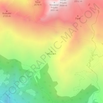
Name: Maurach topographic map, elevation, terrain.
Location: Maurach, Gemeinde Ainet, Bezirk Lienz, Tirol, 9951, Österreich (46.90160 12.70784 46.90170 12.70794)
Average elevation: 7,612 ft
Minimum elevation: 5,105 ft
Maximum elevation: 9,964 ft
Thank you for supporting this site ❤️
Make a donation
Make a donation
Gear up for your next adventure:
As an Amazon Associate, this site earns from qualifying purchases at no extra cost to you.