
Thank you for supporting this site ❤️
Make a donation
Make a donation
Gear up for your next adventure:
As an Amazon Associate, this site earns from qualifying purchases at no extra cost to you.
Khanola topographic map
Click on the map to display elevation.
Thank you for supporting this site ❤️
Make a donation
Make a donation
Gear up for your next adventure:
As an Amazon Associate, this site earns from qualifying purchases at no extra cost to you.
About this map
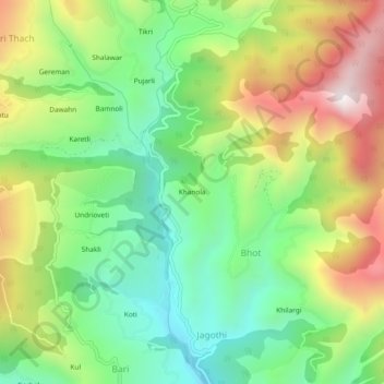
Name: Khanola topographic map, elevation, terrain.
Location: Khanola, Bhot, Rohru, Shimla, Himachal Pradesh, India (31.24397 77.67875 31.28397 77.71875)
Average elevation: 7,044 ft
Minimum elevation: 5,801 ft
Maximum elevation: 8,924 ft
Thank you for supporting this site ❤️
Make a donation
Make a donation
Gear up for your next adventure:
As an Amazon Associate, this site earns from qualifying purchases at no extra cost to you.