Geolocate

Dhoraji topographic map

Click on the map to display elevation.

About this map

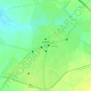
Name: Dhoraji topographic map, elevation, terrain.

Location: Dhoraji, Dhoraji Taluka, Rajkot District, Gujarat, India (21.72079 70.43448 21.74648 70.46065)

Average elevation: 203 ft

Minimum elevation: 164 ft

Maximum elevation: 233 ft

Gear up for your next adventure:

🛠️Outdoor Gear Repair Kit - Essential tools to fix gear on the trail
📷Action Cameras - Rugged cameras to document your journeys across rugged terrain
🪶Wildlife Field Guides - Learn animal tracking and species ID
🥩Freeze-Dried Meals - Nutritious and lightweight food for remote expeditions
🎒Hydration Pack - Hands‑free water reservoir for long hikes

As an Amazon Associate, this site earns from qualifying purchases at no extra cost to you.