
Thank you for supporting this site ❤️
Make a donation
Make a donation
Gear up for your next adventure:
As an Amazon Associate, this site earns from qualifying purchases at no extra cost to you.
Olguín topographic map
Click on the map to display elevation.
Thank you for supporting this site ❤️
Make a donation
Make a donation
Gear up for your next adventure:
As an Amazon Associate, this site earns from qualifying purchases at no extra cost to you.
About this map
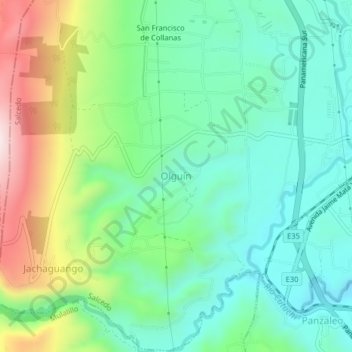
Name: Olguín topographic map, elevation, terrain.
Location: Olguín, Salcedo, Cotopaxi, 050555, Ecuador (-1.07000 -78.63667 -1.03000 -78.59667)
Average elevation: 9,009 ft
Minimum elevation: 8,455 ft
Maximum elevation: 10,259 ft
Thank you for supporting this site ❤️
Make a donation
Make a donation
Gear up for your next adventure:
As an Amazon Associate, this site earns from qualifying purchases at no extra cost to you.