
Thank you for supporting this site ❤️
Make a donation
Make a donation
Gear up for your next adventure:
As an Amazon Associate, this site earns from qualifying purchases at no extra cost to you.
东汝乡 topographic map
Click on the map to display elevation.
Thank you for supporting this site ❤️
Make a donation
Make a donation
Gear up for your next adventure:
As an Amazon Associate, this site earns from qualifying purchases at no extra cost to you.
About this map
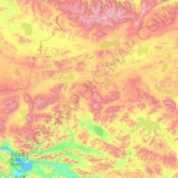
Name: 东汝乡 topographic map, elevation, terrain.
Location: 东汝乡, 日土县, མངའ་རིས་ས་ཁུལ་ 阿里地区, Tibet, China (33.48415 79.79671 35.45088 82.45823)
Average elevation: 17,208 ft
Minimum elevation: 13,907 ft
Maximum elevation: 23,002 ft
Thank you for supporting this site ❤️
Make a donation
Make a donation
Gear up for your next adventure:
As an Amazon Associate, this site earns from qualifying purchases at no extra cost to you.