
Thank you for supporting this site ❤️
Make a donation
Make a donation
Gear up for your next adventure:
As an Amazon Associate, this site earns from qualifying purchases at no extra cost to you.
Melrose topographic map
Click on the map to display elevation.
Thank you for supporting this site ❤️
Make a donation
Make a donation
Gear up for your next adventure:
As an Amazon Associate, this site earns from qualifying purchases at no extra cost to you.
About this map
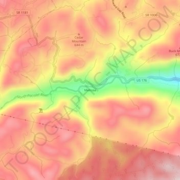
Name: Melrose topographic map, elevation, terrain.
Location: Melrose, Polk County, North Carolina, 28773, United States (35.19956 -82.34262 35.23956 -82.30262)
Average elevation: 2,001 ft
Minimum elevation: 1,168 ft
Maximum elevation: 2,434 ft
Polk County trails, hiking, mountain biking, running and outdoor activities
Thank you for supporting this site ❤️
Make a donation
Make a donation
Gear up for your next adventure:
As an Amazon Associate, this site earns from qualifying purchases at no extra cost to you.