Geolocate

Camerano topographic map

Click on the map to display elevation.

About this map

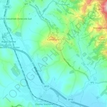
Name: Camerano topographic map, elevation, terrain.

Location: Camerano, Ancona, Marche, 60021, Italia (43.49408 13.51506 43.55296 13.57881)

Average elevation: 243 ft

Minimum elevation: 30 ft

Maximum elevation: 1,217 ft

Gear up for your next adventure:

🔥Fast-Boil Camping Stoves - Efficient cooking systems for quick trail meals
🏕️Tent Footprint - Protect your tent base from wear
🧭GPS Watch Accessories - Bands and chargers for GPS watches
📚USA Hiking Guide Books - Top trail guides and map books
🪶Compact Camp Shovel - Folding shovel for campsite tasks

As an Amazon Associate, this site earns from qualifying purchases at no extra cost to you.