Geolocate

Reminderville topographic map

Click on the map to display elevation.

About this map

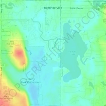
Name: Reminderville topographic map, elevation, terrain.

Location: Reminderville, Summit County, Ohio, United States (41.31175 -81.41903 41.34849 -81.39168)

Average elevation: 1,024 ft

Minimum elevation: 974 ft

Maximum elevation: 1,158 ft

Summit County trails, hiking, mountain biking, running and outdoor activities

Gear up for your next adventure:

🗺️Topographic Maps - Detailed topo maps for hiking, exploring and outdoor navigation
🧥Waterproof Jacket for Hiking - Breathable and rugged rain jacket for outdoor excursions
🪵Folding Camp Saw - Compact saw for wood and campsite work
📶Satellite Messenger - Communication device off‑grid
🪶Trail Camera - Capture wildlife on your hikes

As an Amazon Associate, this site earns from qualifying purchases at no extra cost to you.