
Thank you for supporting this site ❤️
Make a donation
Make a donation
Gear up for your next adventure:
As an Amazon Associate, this site earns from qualifying purchases at no extra cost to you.
Rognée topographic map
Click on the map to display elevation.
Thank you for supporting this site ❤️
Make a donation
Make a donation
Gear up for your next adventure:
As an Amazon Associate, this site earns from qualifying purchases at no extra cost to you.
About this map
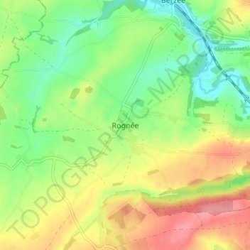
Name: Rognée topographic map, elevation, terrain.
Location: Rognée, Walcourt, Philippeville, Namur, Wallonia, 5651, Belgium (50.24915 4.36921 50.28915 4.40921)
Average elevation: 617 ft
Minimum elevation: 482 ft
Maximum elevation: 791 ft
Thank you for supporting this site ❤️
Make a donation
Make a donation
Gear up for your next adventure:
As an Amazon Associate, this site earns from qualifying purchases at no extra cost to you.