
Thank you for supporting this site ❤️
Make a donation
Make a donation
Gear up for your next adventure:
As an Amazon Associate, this site earns from qualifying purchases at no extra cost to you.
Castellavazzo topographic map
Click on the map to display elevation.
Thank you for supporting this site ❤️
Make a donation
Make a donation
Gear up for your next adventure:
As an Amazon Associate, this site earns from qualifying purchases at no extra cost to you.
About this map
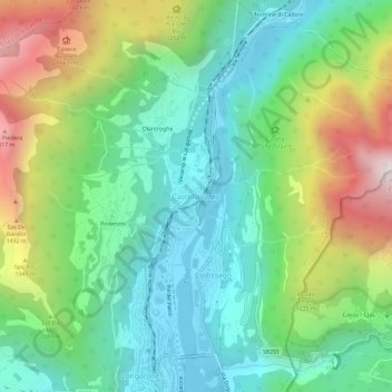
Name: Castellavazzo topographic map, elevation, terrain.
Location: Castellavazzo, Longarone, Belluno, Veneto, 32013, Italia (46.26411 12.28814 46.30411 12.32814)
Average elevation: 3,081 ft
Minimum elevation: 1,414 ft
Maximum elevation: 6,555 ft
Thank you for supporting this site ❤️
Make a donation
Make a donation
Gear up for your next adventure:
As an Amazon Associate, this site earns from qualifying purchases at no extra cost to you.