Geolocate

Balaclava topographic map

Click on the map to display elevation.

About this map

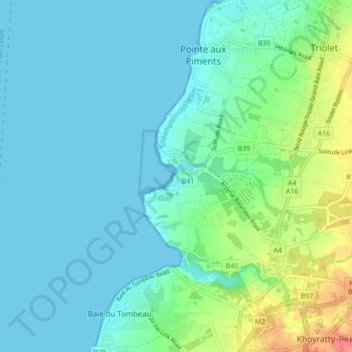
Name: Balaclava topographic map, elevation, terrain.

Location: Balaclava, Pamplemousses, 21733, Mauritius (-20.12658 57.47620 -20.04658 57.55620)

Average elevation: 56 ft

Minimum elevation: 0 ft

Maximum elevation: 269 ft

Gear up for your next adventure:

🔥Fast-Boil Camping Stoves - Efficient cooking systems for quick trail meals
🦶Carbon Trekking Poles - Reduce knee impact on steep descents with ultra-light poles
🪶LED Camping Lantern - Bright lantern for camp lighting
🕶️Glacier Sunglasses - Side shields to protect eyes from high-altitude snow glare
🔥Plasma Lighters - Windproof lighters that work in any weather condition

As an Amazon Associate, this site earns from qualifying purchases at no extra cost to you.