Geolocate

Granger topographic map

Click on the map to display elevation.

About this map

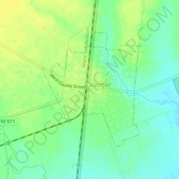
Name: Granger topographic map, elevation, terrain.

Location: Granger, Williamson County, Texas, United States (30.70875 -97.45131 30.72607 -97.43406)

Average elevation: 568 ft

Minimum elevation: 535 ft

Maximum elevation: 597 ft

Williamson County trails, hiking, mountain biking, running and outdoor activities

Gear up for your next adventure:

🍳Camping Cook Set - Complete cookware for outdoor meals
🏫Relief Map Kits - Hands-on tools for teaching landforms and elevation
🎒Day Hiking Backpack - Lightweight backpack perfect for day trips and outdoor adventures
⛑️Personal Locator Beacon - Safety beacon for emergencies
👟Men's Trail Runners - Lightweight footwear for fast-paced exploration and light hiking

As an Amazon Associate, this site earns from qualifying purchases at no extra cost to you.