
Kraft topographic map
Click on the map to display elevation.
About this map
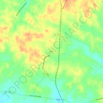
Name: Kraft topographic map, elevation, terrain.
Location: Kraft, Hardin County, Kentucky, 40162, United States (37.69701 -85.99080 37.73701 -85.95080)
Average elevation: 810 ft
Minimum elevation: 745 ft
Maximum elevation: 869 ft
Hardin County trails, hiking, mountain biking, running and outdoor activities