Geolocate

North Forest topographic map

Click on the map to display elevation.

About this map

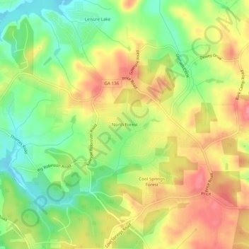
Name: North Forest topographic map, elevation, terrain.

Location: North Forest, Hall County, Georgia, 50564, United States (34.37760 -83.95685 34.41760 -83.91685)

Average elevation: 1,207 ft

Minimum elevation: 1,063 ft

Maximum elevation: 1,345 ft

Hall County trails, hiking, mountain biking, running and outdoor activities

Gear up for your next adventure:

🎒Waterproof Dry Bags - Keep your electronics and maps dry inside your pack
📌Outdoor GPS Map App - Apps and devices for digital topographic navigation
📶Satellite Messenger - Communication device off‑grid
Solar GPS Watches - Advanced multisport watches with built-in topographic maps
📡GPS Antenna Upgrade - Enhance GPS reception in remote terrain

As an Amazon Associate, this site earns from qualifying purchases at no extra cost to you.