
Thank you for supporting this site ❤️
Make a donation
Make a donation
Gear up for your next adventure:
As an Amazon Associate, this site earns from qualifying purchases at no extra cost to you.
Sjörröd topographic map
Click on the map to display elevation.
Thank you for supporting this site ❤️
Make a donation
Make a donation
Gear up for your next adventure:
As an Amazon Associate, this site earns from qualifying purchases at no extra cost to you.
About this map
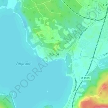
Name: Sjörröd topographic map, elevation, terrain.
Location: Sjörröd, Hässleholms kommun, Skåne County, 281 35, Sweden (56.11974 13.70670 56.15974 13.74670)
Average elevation: 164 ft
Minimum elevation: 125 ft
Maximum elevation: 367 ft
Thank you for supporting this site ❤️
Make a donation
Make a donation
Gear up for your next adventure:
As an Amazon Associate, this site earns from qualifying purchases at no extra cost to you.