Geolocate

Simmesport topographic map

Click on the map to display elevation.

About this map

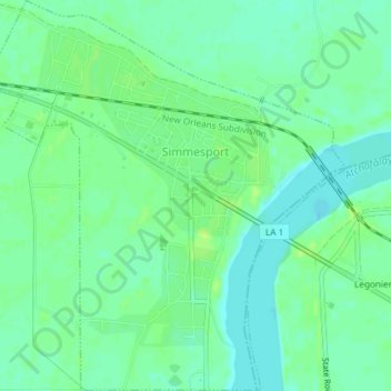
Name: Simmesport topographic map, elevation, terrain.

Location: Simmesport, Avoyelles Parish, Louisiana, United States (30.96483 -91.83094 30.99655 -91.79652)

Average elevation: 46 ft

Minimum elevation: 23 ft

Maximum elevation: 69 ft

Gear up for your next adventure:

🧴Hand Sanitizer - Keep hands clean while hiking
🧥Waterproof Jacket for Hiking - Breathable and rugged rain jacket for outdoor excursions
🌡️Handheld Weather Meters - Measure wind, temp, and pressure for safe mountain travel
Backpacking Tents - Weight-optimized shelters for multi-day topographic surveys
📻Weather Alert Radios - Stay informed of storm risks while off-the-grid

As an Amazon Associate, this site earns from qualifying purchases at no extra cost to you.