
Thank you for supporting this site ❤️
Make a donation
Make a donation
Gear up for your next adventure:
As an Amazon Associate, this site earns from qualifying purchases at no extra cost to you.
Seymour topographic map
Click on the map to display elevation.
Thank you for supporting this site ❤️
Make a donation
Make a donation
Gear up for your next adventure:
As an Amazon Associate, this site earns from qualifying purchases at no extra cost to you.
About this map
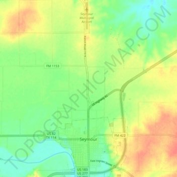
Name: Seymour topographic map, elevation, terrain.
Location: Seymour, Baylor County, Texas, 76380, United States (33.57758 -99.28730 33.65528 -99.23953)
Average elevation: 1,316 ft
Minimum elevation: 1,243 ft
Maximum elevation: 1,398 ft
Thank you for supporting this site ❤️
Make a donation
Make a donation
Gear up for your next adventure:
As an Amazon Associate, this site earns from qualifying purchases at no extra cost to you.