Geolocate

Surcubamba topographic map

Click on the map to display elevation.

About this map

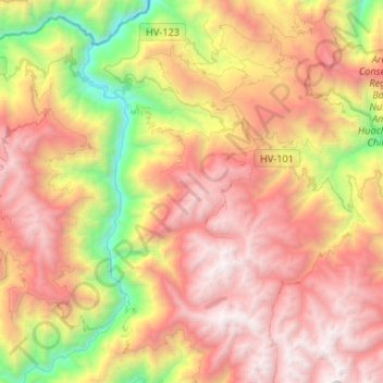
Name: Surcubamba topographic map, elevation, terrain.

Location: Surcubamba, Province of Tayacaja, Huancavelica, Peru (-12.28873 -74.75907 -12.03044 -74.52184)

Average elevation: 9,587 ft

Minimum elevation: 3,606 ft

Maximum elevation: 15,000 ft

Gear up for your next adventure:

🗃️Trail First Aid Kit - Essential kit for outdoor injuries and emergencies
🛏️Cold Weather Sleeping Bag - Warm sleeping bag for cold conditions
🕶️GPS Smartphone Mount - Secure mount for phone navigation
🏔️Mountain Trail Maps - High‑detail maps for popular peaks
Backpacking Tents - Weight-optimized shelters for multi-day topographic surveys

As an Amazon Associate, this site earns from qualifying purchases at no extra cost to you.