Geolocate

Bowleys Quarters topographic map

Click on the map to display elevation.

About this map

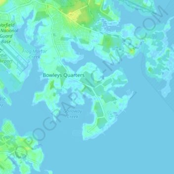
Name: Bowleys Quarters topographic map, elevation, terrain.

Location: Bowleys Quarters, Baltimore County, Maryland, United States (39.28851 -76.40905 39.33856 -76.36025)

Average elevation: 7 ft

Minimum elevation: -16 ft

Maximum elevation: 49 ft

Baltimore County trails, hiking, mountain biking, running and outdoor activities

Gear up for your next adventure:

🪶Compact Camp Shovel - Folding shovel for campsite tasks
🧺Microfiber Travel Towels - Compact and fast-drying towels for trail use
🪶Fire Starter Kit - Reliable fire starter for survival and camping
💧Water Filtration Bottles - Safely drink from streams and lakes while exploring
🧭Hiking Compass - Precision compass for reliable navigation in the wilderness

As an Amazon Associate, this site earns from qualifying purchases at no extra cost to you.