Geolocate

Alpine Bay topographic map

Click on the map to display elevation.

About this map

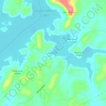
Name: Alpine Bay topographic map, elevation, terrain.

Location: Alpine Bay, Talladega County, Alabama, United States (33.42816 -86.31525 33.46816 -86.27525)

Average elevation: 518 ft

Minimum elevation: 449 ft

Maximum elevation: 794 ft

Talladega County trails, hiking, mountain biking, running and outdoor activities

Gear up for your next adventure:

🦶Carbon Trekking Poles - Reduce knee impact on steep descents with ultra-light poles
🏕️Tent Footprint - Protect your tent base from wear
🧢Sun Protection Hats - Wide-brimmed and UPF-rated hats for high-altitude sun safety
🚑Emergency Bivvies - Heat-reflective sleeping bags for survival situations
📦Gear Storage Bags - Organize and protect outdoor equipment

As an Amazon Associate, this site earns from qualifying purchases at no extra cost to you.