
Thank you for supporting this site ❤️
Make a donation
Make a donation
Gear up for your next adventure:
As an Amazon Associate, this site earns from qualifying purchases at no extra cost to you.
Şerifali topographic map
Click on the map to display elevation.
Thank you for supporting this site ❤️
Make a donation
Make a donation
Gear up for your next adventure:
As an Amazon Associate, this site earns from qualifying purchases at no extra cost to you.
About this map
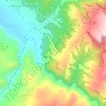
Name: Şerifali topographic map, elevation, terrain.
Location: Şerifali, Havza, Samsun, Black Sea Region, Turkey (41.09473 35.61171 41.13473 35.65171)
Average elevation: 1,690 ft
Minimum elevation: 1,119 ft
Maximum elevation: 2,493 ft
Thank you for supporting this site ❤️
Make a donation
Make a donation
Gear up for your next adventure:
As an Amazon Associate, this site earns from qualifying purchases at no extra cost to you.