Geolocate

Mont-Valin topographic map

Click on the map to display elevation.

About this map

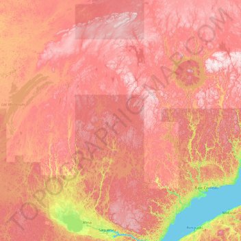
Name: Mont-Valin topographic map, elevation, terrain.

Location: Mont-Valin, Le Fjord-du-Saguenay, Saguenay–Lac-Saint-Jean, Quebec, Canada (48.25059 -71.51401 52.69475 -70.00799)

Average elevation: 1,529 ft

Minimum elevation: 0 ft

Maximum elevation: 3,517 ft

Other topographic maps

Click on a map to view its topography, its elevation and its terrain.

Lac Chevreuil

Canada > Quebec > Le Fjord-du-Saguenay > Mont-Valin

Average elevation: 2,552 ft

Lac Louisa

Canada > Quebec > Le Fjord-du-Saguenay > Mont-Valin

Average elevation: 2,018 ft

Lac du Cardinal

Canada > Quebec > Le Fjord-du-Saguenay > Mont-Valin

Average elevation: 1,762 ft

Lac Duhamel

Canada > Quebec > Le Fjord-du-Saguenay > Mont-Valin

Average elevation: 1,483 ft

Lac Unique

Canada > Quebec > Le Fjord-du-Saguenay > Mont-Valin

Average elevation: 2,523 ft

Lac Brock

Canada > Quebec > Le Fjord-du-Saguenay > Mont-Valin

Average elevation: 2,037 ft

Lac Louisa

Canada > Quebec > Le Fjord-du-Saguenay > Mont-Valin

Average elevation: 2,018 ft

Gear up for your next adventure:

🧷Carabiner Set - Durable clips for gear attachment
📦Dry Bags Set - Waterproof storage for electronics and clothes
🪑Ultralight Camp Chairs - Portable seating for resting after a long day of mapping
🦟Ultrasonic Repellers - Create a bug-free zone at your camp or rest stop
🦶Carbon Trekking Poles - Reduce knee impact on steep descents with ultra-light poles

As an Amazon Associate, this site earns from qualifying purchases at no extra cost to you.