Geolocate

Salogni topographic map

Click on the map to display elevation.

About this map

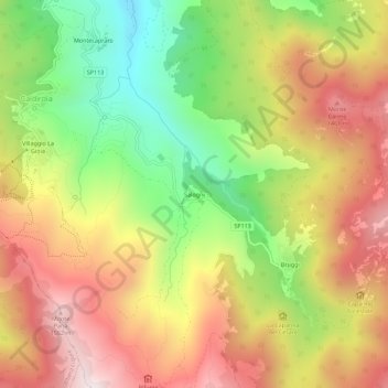
Name: Salogni topographic map, elevation, terrain.

Location: Salogni, Fabbrica Curone, Alessandria, Piemonte, 15054, Italia (44.69827 9.15328 44.73827 9.19328)

Average elevation: 3,770 ft

Minimum elevation: 2,208 ft

Maximum elevation: 5,259 ft

Gear up for your next adventure:

🚗GPS Dash Cams - Record your scenic drives through mountain passes and canyons
🗃️Trail First Aid Kit - Essential kit for outdoor injuries and emergencies
💧Water Purification System - Clean water on the trail with reliable purifiers
🖼️Topo Map Wall Art - Decorative topographic prints of famous peaks and regions
🎒Outdoor Daypacks - Lightweight backpacks designed for carrying maps and essential gear

As an Amazon Associate, this site earns from qualifying purchases at no extra cost to you.