
Hemyock topographic map
Click on the map to display elevation.
About this map
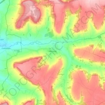
Name: Hemyock topographic map, elevation, terrain.
Location: Hemyock, Mid Devon, Devon, England, United Kingdom (50.87644 -3.26542 50.94605 -3.17906)
Average elevation: 630 ft
Minimum elevation: 315 ft
Maximum elevation: 906 ft
Other topographic maps
Click on a map to view its topography, its elevation and its terrain.
White Cross
United Kingdom > England > Devon > Mid Devon > Cheriton Fitzpaine
Average elevation: 430 ft
Bailey
United Kingdom > England > Devon > Mid Devon > Newton St. Cyres > Bailey
Average elevation: 299 ft