Geolocate

Kebad topographic map

Click on the map to display elevation.

About this map

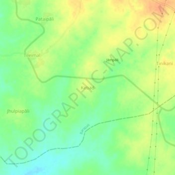
Name: Kebad topographic map, elevation, terrain.

Location: Kebad, Barapali, Bargarh, Odisha, India (21.05944 83.50563 21.09944 83.54563)

Average elevation: 558 ft

Minimum elevation: 499 ft

Maximum elevation: 614 ft

Gear up for your next adventure:

🪵Folding Camp Saw - Compact saw for wood and campsite work
🥄Camping Utensil Set - Lightweight utensils for outdoor meals
🗺️NatGeo Topo Maps - High-quality waterproof printed topographic maps of US Parks
🔋Solar Power Banks - Keep your GPS and phone charged in remote wilderness areas
Camping Coffee Makers - Enjoy premium coffee at the summit or campsite

As an Amazon Associate, this site earns from qualifying purchases at no extra cost to you.