
Thank you for supporting this site ❤️
Make a donation
Make a donation
Gear up for your next adventure:
As an Amazon Associate, this site earns from qualifying purchases at no extra cost to you.
Valbusa topographic map
Click on the map to display elevation.
Thank you for supporting this site ❤️
Make a donation
Make a donation
Gear up for your next adventure:
As an Amazon Associate, this site earns from qualifying purchases at no extra cost to you.
About this map
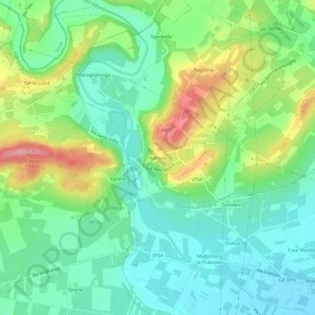
Name: Valbusa topographic map, elevation, terrain.
Location: Valbusa, Custoza, Sommacampagna, Verona, Veneto, 37066, Italia (45.35444 10.76931 45.39444 10.80931)
Average elevation: 318 ft
Minimum elevation: 184 ft
Maximum elevation: 587 ft
Thank you for supporting this site ❤️
Make a donation
Make a donation
Gear up for your next adventure:
As an Amazon Associate, this site earns from qualifying purchases at no extra cost to you.