Geolocate

Trebisacce topographic map

Click on the map to display elevation.

About this map

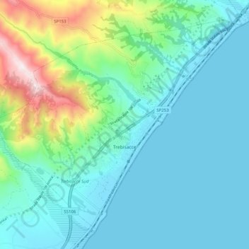
Name: Trebisacce topographic map, elevation, terrain.

Location: Trebisacce, Cosenza, Calabria, 87075, Italy (39.84480 16.47757 39.90839 16.57733)

Average elevation: 495 ft

Minimum elevation: -3 ft

Maximum elevation: 2,546 ft

Gear up for your next adventure:

🧢Sun Protection Hats - Wide-brimmed and UPF-rated hats for high-altitude sun safety
🔥Fast-Boil Camping Stoves - Efficient cooking systems for quick trail meals
📷Action Camera - Capture your outdoor adventures in HD
🛡️Insect Repellent - Protection against bugs during outdoor activities
🧣Hiking Neck Gaiter - Multi‑use neck protection for outdoor weather

As an Amazon Associate, this site earns from qualifying purchases at no extra cost to you.