
Purus River topographic map
Click on the map to display elevation.
Purus River
William Chandless found its elevation above sea level to be only 107 feet (33 m) 590 miles (950 km) from its mouth. It is one of the most crooked streams in the world, and its length in a straight line is less than half of its length following its curves. It is practically only a drainage ditch for the half-submerged, lake-flooded district it crosses. Its width is very uniform for 1,000 miles (1,600 km) up, and for 800 miles (1,300 km) its depth is never less than 45 feet (14 m).
About this map
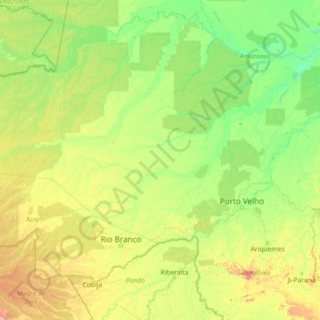
Name: Purus River topographic map, elevation, terrain.
Location: Purus River, North Region, Brazil (-10.74853 -71.79535 -3.66480 -61.36902)
Average elevation: 436 ft
Minimum elevation: 36 ft
Maximum elevation: 4,741 ft
Other topographic maps
Click on a map to view its topography, its elevation and its terrain.
Domingos Martins
Brazil > Espírito Santo > Domingos Martins > Domingos Martins
Average elevation: 2,044 ft