

Solan topographic map
Click on the map to display elevation.
Solan
Solan is a city in the Indian state of Himachal Pradesh and the district headquarters of Solan district. It is located 45.5 kilometres (28 mi) south of the state capital, Shimla. Solan has an average elevation of 1,550 metres (5,090 ft). The city is situated between Chandigarh (joint capital of Punjab and Haryana) and Shimla (state capital) on the Kalka-Shimla National Highway-5. The narrow-gauge Kalka-Shimla railway passes through Solan. Located on the Punjab-Himachal Border, Solan is nestled in the Shivalik hills of the Himalayas.
About this map
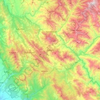
Name: Solan topographic map, elevation, terrain.
Location: Solan, Himachal Pradesh, 173212, India (30.74776 76.94236 31.06776 77.26236)
Average elevation: 4,304 ft
Minimum elevation: 1,404 ft
Maximum elevation: 8,392 ft