Geolocate

Tampico topographic map

Click on the map to display elevation.

About this map

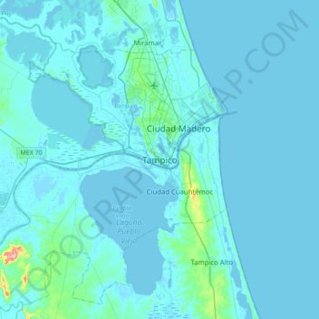
Name: Tampico topographic map, elevation, terrain.

Location: Tampico, Tamaulipas, 89080, Mexico (22.05576 -98.01777 22.37576 -97.69777)

Average elevation: 23 ft

Minimum elevation: -13 ft

Maximum elevation: 469 ft

Gear up for your next adventure:

🔦LED Headlamp - Bright and durable LED headlamp for night navigation
🌡️Handheld Weather Meters - Measure wind, temp, and pressure for safe mountain travel
📚Navigation Handbooks - Master the art of reading topographic maps and using a compass
🛶Inflatable Kayak - Portable kayak for rivers, lakes, and expeditions
🪵Folding Camp Saw - Compact saw for wood and campsite work

As an Amazon Associate, this site earns from qualifying purchases at no extra cost to you.