Geolocate

Dharampur topographic map

Click on the map to display elevation.

About this map

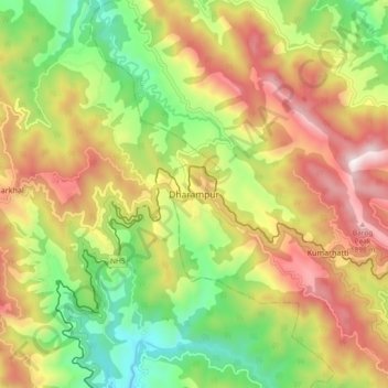
Name: Dharampur topographic map, elevation, terrain.

Location: Dharampur, Solan, Himachal Pradesh, 173209, India (30.86044 76.98478 30.94044 77.06478)

Average elevation: 4,688 ft

Minimum elevation: 3,120 ft

Maximum elevation: 6,486 ft

Gear up for your next adventure:

🪶Trail Camera - Capture wildlife on your hikes
🏥Hiking First Aid Kits - Comprehensive medical kits for remote trail injuries
🧤Hiking Gloves - Protective gloves for rugged trails
🔋Solar Power Banks - Keep your GPS and phone charged in remote wilderness areas
🎒Day Hiking Backpack - Lightweight backpack perfect for day trips and outdoor adventures

As an Amazon Associate, this site earns from qualifying purchases at no extra cost to you.